
 Northern and Central Velebit · Croatia
Premužić Trail Velebit
Velebit's dry-stone traverse, hut to hut

About Premužić Trail Velebit
The Premužić Trail (Premužićeva staza) follows the crest of northern and central Velebit for 48 kilometres, from the mountain hut at Zavižan to the pass village of Baške Oštarije. The forestry engineer Ante Premužić laid it out between 1930 and 1933, and the dry-stone technique has held for ninety years: a path about 1.2 metres wide, with an average gradient of ten per cent and a steepest section of twenty per cent at the Crikvena saddle. In 2009 the whole route was protected as a cultural asset of national importance.
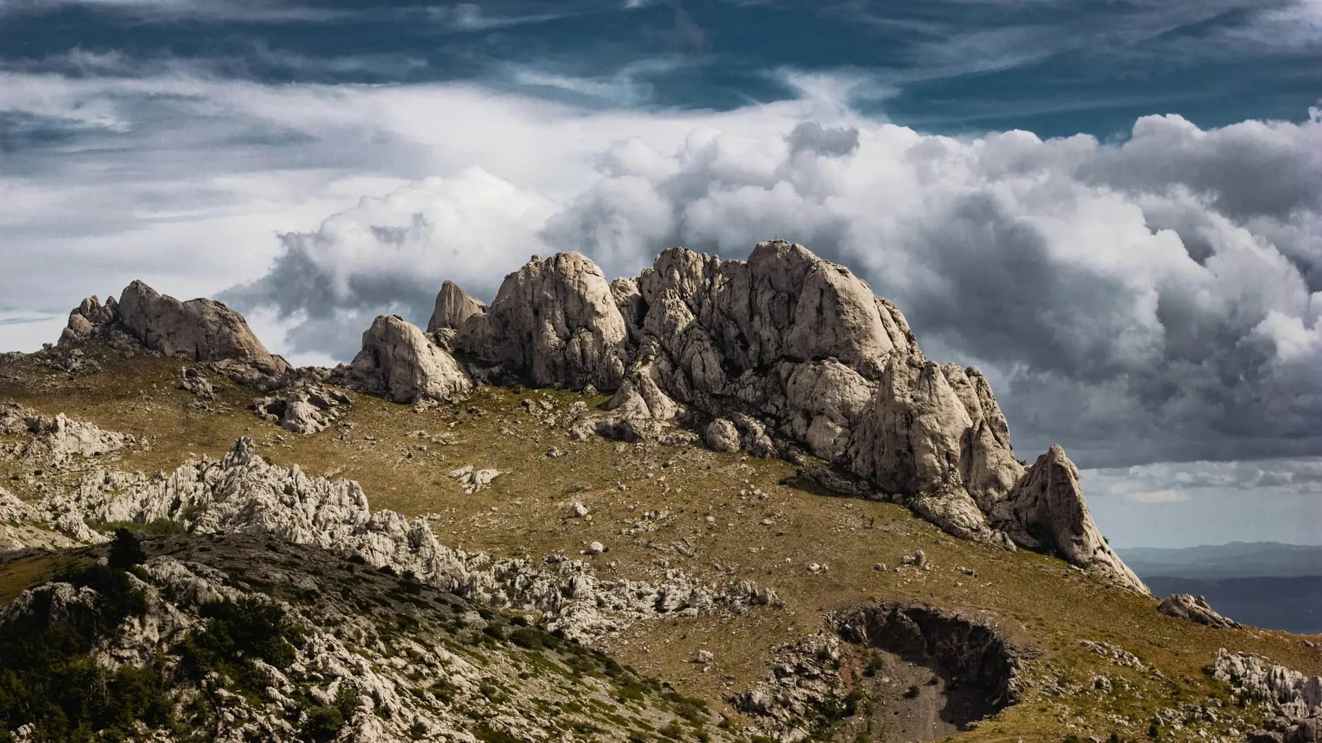
The first sixteen kilometres run through Northern Velebit National Park, past the weather station at Zavižan, Rossi's shelter and the limestone towers of Hajdučki i Rožanski kukovi. The Kukovi are a strict reserve and closed to walkers without a permit; the path runs along its edge, which is the point of the whole design. South of the park the route continues through Velebit Nature Park on the same stone, above beech forest and abandoned shepherd hamlets, with the Kvarner islands on one side and the Lika plateau on the other.
Practical. Three stages of 14.7, 19.3 and 11.9 kilometres, each ending at a roof: the Alan hut at 1,340 metres on the first night, the open shelter at Skorpovac at 958 metres on the second. Alan has 44 places and is staffed in summer, with drinks and simple food; Skorpovac has twenty places on simple bunks, a wood stove and rainwater in a cistern that is not for drinking, and no warden at all. Bring a sleeping bag and carry water for the second evening from Alan. Camping and fires are forbidden inside the park. The huts at Zavižan and Alan are the only places that sell drinks; there is no drinkable water on the trail itself.
Getting there. The Lika Line bus connects Senj and Krasno and stops at Babić Sića, the park entrance, from where the local transfer service Dragec prijevoz takes walkers up to Zavižan. From the southern end, the Lika Line bus runs between Gospić, Baške Oštarije and Karlobag. The park gate at Babić Sića is open daily from 08:00 to 16:00; outside those hours a car cannot get in, so plan the drive up to Zavižan inside them. The season runs from June to September; snow can lie on the northern ridges into May.
Stages Premužić Trail Velebit
The Premužić Trail Velebit is split here into 3 stages of 14 to 20 km, 48 km in total, from Zavižan – Alan hut to Skorpovac shelter – Baške Oštarije. The stages below are a sample itinerary: in the planner you put together your own days and choose where you sleep.
Zavižan – Alan hut
The day starts on the road below the Zavižan hut, where the weather station and the first metres of stone meet. Vučjak rises directly above at 1,644 m, a short climb for the view over the Kvarner islands, and the path then settles into the long contour that Ante Premužić cut for exactly this terrain. Rossi's shelter at the seventh kilometre is timber and open; Gromovača, at 1,675 m the highest summit of northern Velebit, is a marked spur of a few hundred metres above the trail. Past the Crikvena saddle, the steepest twenty per cent of the whole route, the limestone towers of Hajdučki i Rožanski kukovi stand to the left behind their reserve boundary. Alan appears below the pass at 1,340 m, a wooden hut beside the Velebit road.
Alan hut – Skorpovac shelter
This is the long day: 19.3 km through Velebit Nature Park, on the same dry stone, with no village and no tap in between. The path leaves the pass road and follows the ridge south above beech forest, crossing open limestone where the view reaches the sea and the islands of Rab and Pag, then back into shade where the rock closes in. The old shepherd hamlet of Skorpovac appears at 958 m, roofless walls among grass, and the shelter stands a few steps off the path beside it: steel and timber, twenty places, a stove, and a cistern of rainwater that is not for drinking. There is nothing else here, which is why the water for the evening comes up from Alan in your pack.
Skorpovac shelter – Baške Oštarije
The last stage drops 11.9 km from the shelter to the pass village at 927 m. The stone path holds its line a little longer above the forest, then the descent begins in earnest through beech and juniper, with the Velebit wall behind you and the coast opening ahead. Baške Oštarije is a village of a few dozen people on the road between Lika and the Adriatic, with a hostel, a campsite and the main road where the buses stop. From here the Velebit Hiking Trail carries on south towards Paklenica, but the Premužić path ends at the village.
FAQ
Below you'll find answers to some frequently asked questions.
Ready to Explore Premužić Trail Velebit?
Start planning your adventure today!
Open this trip in the free Vandra mobile app and copy it to your own account, so you can edit it and plan freely, exactly the way you want.