
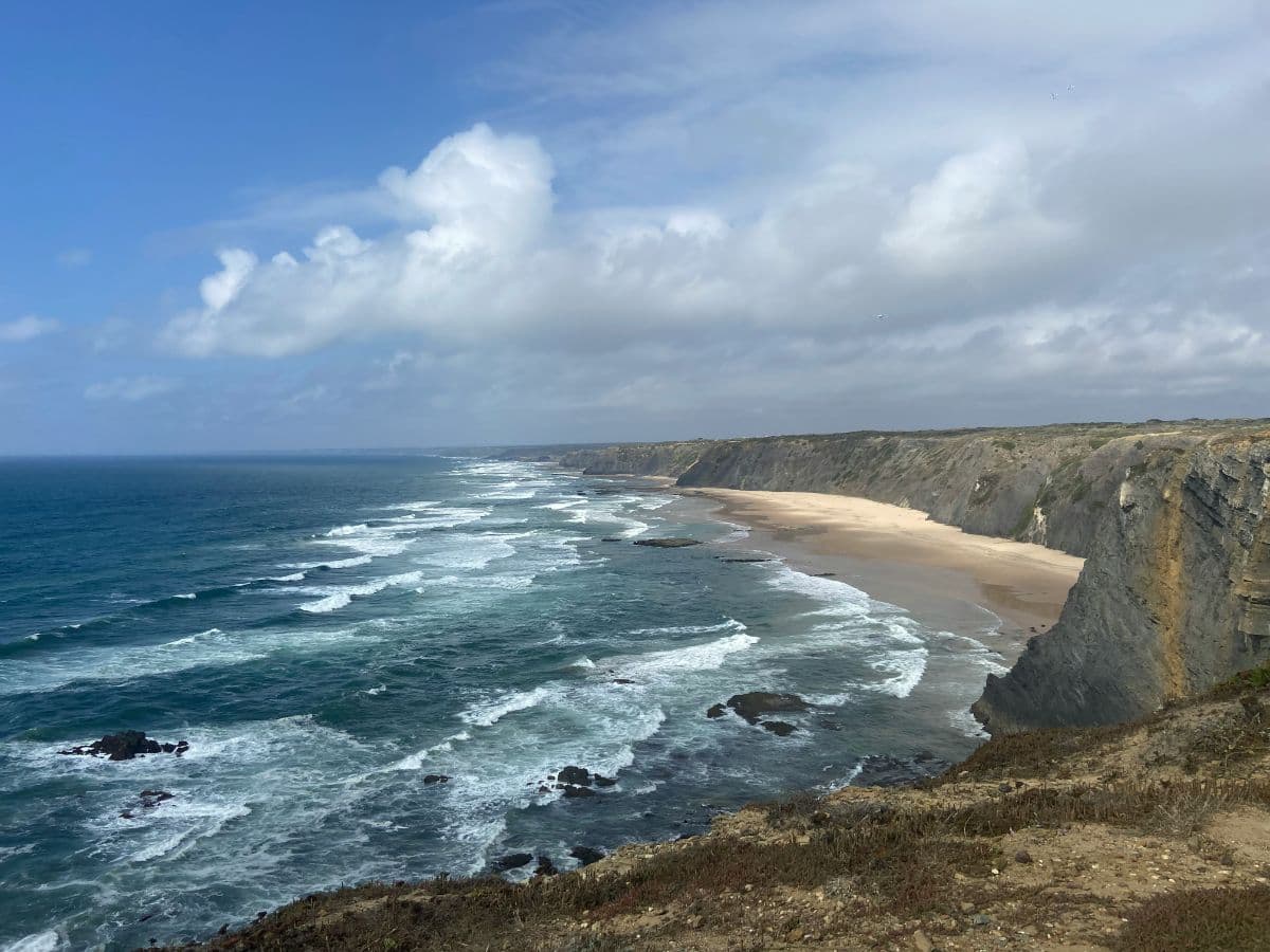
 Costa Vicentina · Portugal
Fishermen's Trail
Cliffs, sand and fishing villages

About This Trip
The Fishermen's Trail is the coastal route of the Rota Vicentina: 220 kilometres of clifftop paths, dune crossings and boardwalks between Porto Covo and Lagos, divided into thirteen short stages. The trail follows the paths local fishermen have used for generations to reach their fishing spots, and it stays close to the ocean almost the entire way.
Do not be fooled by the low altitudes: between 60 and 70 percent of the route is soft sand, which makes it physically demanding despite the gentle profile. There is no technical climbing, but the trail is exposed to the wind and to cliff edges, and it is not recommended if you suffer from vertigo. The route is waymarked with blue and green markers and can be walked in both directions.
The trail lies in a protected natural park with a very fragile ecosystem, so follow the markings and stay on the path. Wild camping is not allowed; use the campsites in the villages along the way. Accommodation ranges from campsites and hostels to guesthouses and small hotels in every stage town, so you never carry more than a day pack if you book ahead. The official season runs from September to June: summer is too hot with little shade, while spring brings the famous flower carpet on the cliffs.
Practical
Getting there. The start is reached via Lisbon: trains and buses run to Sines or Porto Covo, and the first stage begins at nearby Praia de S. Torpes. From Lagos at the finish, trains connect back towards Lisbon.
Stages. Thirteen stages between 10 and 23 kilometres, walkable in 3 to 6.5 hours each, with village accommodation every night. Several stages can be combined if you want a shorter trip.
Stages
Planning a multi-day hike often takes more time than expected. Which route matches your experience level? Where will you stay overnight? Are the accommodations available? We have done the preparation for you. With carefully curated routes, accommodations and highlights, you can easily plan your next adventure.
S. Torpes - Porto Covo
The trail begins on the wide beach of S. Torpes, where dunes and pine forest meet the ocean. The path follows the clifftop south past quiet coves, with the port of Sines visible behind you, and descends into the whitewashed lanes of Porto Covo, a fishing village around a sheltered bay.
Porto Covo - Vila Nova de Milfontes
A day of wild beaches and cliff views. The path crosses the dunes past Praia da Ilha do Pessegueiro, with its ruined fort on a rocky islet, then runs along the coast to the Mira estuary, where Vila Nova de Milfontes greets you with its small fortress above the river.
Vila Nova de Milfontes - Almograve
The route leaves the Mira river and follows low cliffs above hidden coves. At Praia dos Alteirinhos a short detour leads down to a beach enclosed by rock walls, and the day ends in Almograve, a quiet village on the edge of dunes and pine woods.
Almograve - Zambujeira do Mar
The longest stretch along the open cliffs. The path passes the lighthouse of Cabo Sardão, where white storks nest on the sea stacks directly above the ocean, an unusual sight anywhere in the world. The day finishes in Zambujeira do Mar, a village perched above a sweeping sandy bay.
Zambujeira do Mar - Odeceixe
A day of beaches: Praia da Carvalhal, the sheltered Praia de Odeceixe and the wide crescent where the Seixe river meets the ocean on the Alentejo-Algarve border. The village of Odeceixe sits on its hill inland from the sea, surrounded by cultivated fields.
Odeceixe - Aljezur
The trail turns away from the shore and follows the Seixe valley through farmland and eucalyptus. After crossing into the Algarve the path climbs over the hills above the Alfambres stream and descends to Aljezur, a hilltop village crowned by a ruined Moorish castle.
Aljezur - Arrifana
Back to the coast through the valley of the Alfambres, with windmills on the ridges. The path reaches the sea at Praia do Monte Clérigo and rounds the headland to Arrifana, a former fishing hamlet clinging to the cliffs above a narrow bay with a wrecked fort at its entrance.
Arrifana - Carrapateira
One of the wildest days, along high cliffs with the swell breaking far below. The path passes Praia do Canal and the Sculpture of the Fisherman of Aljezur above the beach of Vale Figueiras, then climbs over the dune ridge to the surf village of Carrapateira, beside its vast dune plain.
Carrapateira - Vila do Bispo
The route crosses the great dune field of Carrapateira, a protected landscape of shifting sand between two headlands, then follows the cliffs of Ponta do Castelo with views to Praia do Amado. Inland lanes and old mule tracks bring the day to a close in Vila do Bispo.
Vila do Bispo - Sagres
The trail crosses open scrubland where the wind shapes the vegetation, passing windmills and the quiet valley of Vale Santo. The morning ends at the fortress of Sagres on its massive headland, the place Henry the Navigator once planned the Portuguese voyages of discovery.
Sagres - Salema
The route rounds the base of the great headland below the cliffs of Ponta da Atalaia, with the fort of Beliche above a sheltered cove along the way. The path undulates above small beaches before descending into Salema, a fishing village still devoted to its boats.
Salema - Luz
A shorter day along golden limestone cliffs, whose layered bands glow in the low sun. The path passes the Figueira valley and the beach of Burgau, a tumble of white houses around a slipway, before reaching the broad bay of Praia da Luz.
Luz - Lagos
The final stage follows the golden cliffs east of Luz, past the wave-cut arches of Ponta da Piedade, one of the most photographed coastlines in Portugal. Boardwalks and cliff stairs descend to the harbour, and the trail finishes among the cobbled streets and city walls of Lagos.
FAQ
Below you'll find answers to some frequently asked questions.
Ready to Explore Fishermen's Trail?
Start planning your adventure today!
Open this trip in the free Vandra mobile app and copy it to your own account, so you can edit it and plan freely, exactly the way you want.