 Mullerthal · Luxembourg
Mullerthal Trail
Through Luxembourg's Little Switzerland

About This Trip
Some trails are about distance. The Mullerthal Trail is about geology doing theatre. Over 112 kilometres, divided into three loops of 37 to 40 kilometres each, the trail threads through the Mullerthal (Müllerthal), Luxembourg's Little Switzerland, where the Luxemburg sandstone has eroded into a maze of rocks, crevices, canyons and overhangs that feels more like a fantasy film set than the Benelux. Since 2022 the region is a UNESCO Global Geopark, and the trail itself carries the "Leading Quality Trails - Best of Europe" label, one of the very few in the Low Countries.
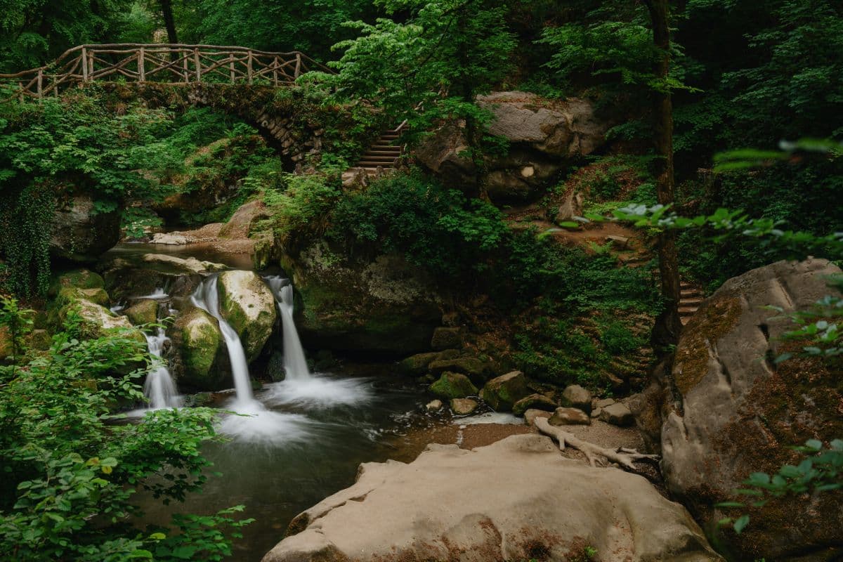
The landmarks have names like fairy tales, and mostly come with legends attached. The Schiessentümpel, where the Black Ernz drops in three arms over a rock ledge beneath a stone bridge built in the 1870s, is the most photographed spot in Luxembourg. The Kuelscheier is a rock crevice the trail runs straight through, so narrow and pitch-dark that a flashlight is standard equipment. The Labyrinth is exactly what the name promises; the Perekop rock is climbed with ladders; the Wollefsschlucht is where wolves sheltered in earlier centuries; and in the Huel Lee cave you can still see the round marks where millstones were cut from the rock. Erosion has carved faces and figures into the sandstone everywhere, and the luminous moss covering the boulders makes the dark gorges glow faintly green.
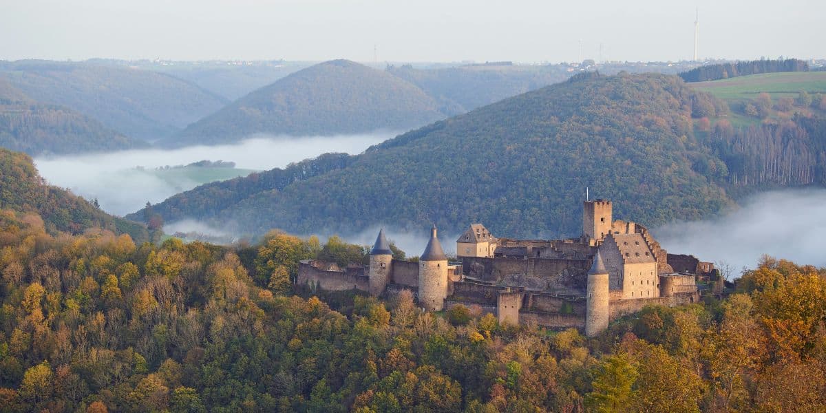
The three loops each have their own character. Route 1 mixes the region's landscapes: rocks, forest, orchard meadows and the Sauer valley. Route 2 is the heart of Little Switzerland and its most spectacular formations, looping from Echternach past Berdorf's rock country to the Schiessentümpel. Route 3 links romantic stream valleys with the castles of Beaufort and Larochette, the latter perched on a sandstone cliff 50 metres above the White Ernz. Base towns are Echternach, Luxembourg's oldest town with its Willibrord basilica and abbey, Berdorf (famous for its cheese), Mullerthal, Beaufort and Larochette.
Practical. Each loop takes two day stages (etappes) of roughly 18 to 20 kilometres; the trail is marked end to end and can be started from any of the towns. The walking is constantly up and down on rocky, root-covered ground, more adventurous than the distances suggest, and sturdy shoes genuinely matter. Bring a flashlight for the Kuelscheier, or take the easy bypass around it. All public transport in Luxembourg is free, so returning to your start point is easy by bus. Best months are late spring to early autumn, when the streams actually flow; after heavy rain the rocky sections can be slippery.
Stages
Planning a multi-day hike often takes more time than expected. Which route matches your experience level? Where will you stay overnight? Are the accommodations available? We have done the preparation for you. With carefully curated routes, accommodations and highlights, you can easily plan your next adventure.
Echternach - Rosport
Start your journey in Echternach, the cultural heart of the Mullerthal region, home to the Saint Willibrord Basilica and a charming old town. The trail follows the Sauer river, the border with Germany, before turning into woodland with impressive rock formations. Above Steinheim you cross open meadows with sweeping views over the Sauer valley before reaching Rosport, where the Tudor Castle and its museum invite a visit.
Rosport - Echternach
From Rosport the trail continues parallel to the Sauer through a patchwork of forest and open orchard meadows towards Moersdorf. The pilgrimage chapel Girsterklaus offers a wonderful viewpoint over the Untersauer valley. After a detour to the Kulturhaff Millermoler in Hinkel, the route climbs over Born to Moersdorf, then heads west through the Hierberbusch nature forest reserve and the woodland of Haardt back to Echternach. Finish the day with a relaxing walk around Echternach lake and a visit to the Roman villa.
Echternach - Mullerthal
Route 2 takes you into the heart of Luxembourg's Little Switzerland. From Echternach the trail climbs past the Trooskneppchen viewpoint with its impressive view back over the town, then leads through the idyllic Schnellert forest to Mullerthal. Here the historic Heringer Mill, now a tourist centre and restaurant, marks the end of the first stage.
Mullerthal - Echternach
The second stage of Route 2 is the trail's highlight reel. Follow the Schwarze Ernz stream to the Schiessentumpel, the picturesque waterfall with its stone bridge that is the landmark of the region. The route then winds past spectacular rock formations including Eileburg, Goldkaul and the narrow Kuelscheier rock fissure, where a flashlight is recommended. Passing Consdorf and Scheidgen, the trail returns through forest and rock landscape to Echternach.
Mullerthal - Beaufort
Route 3 begins in the village of Mullerthal and follows the romantic valley of the Schwarze Ernz towards Beaufort. The trail flows into the impressive Halerbaach valley with its steep rock faces, then continues along the Haupeschbach directly to Beaufort Castle. Take time to visit the castle ruins and taste the famous Cassero blackcurrant liqueur, still produced at the castle today.
Beaufort - Mullerthal
From Beaufort the trail leads out through open landscape and charming forest sections, past Medernach to Larochette, where the vast castle ruins tower above the village. The return leg follows the Wisse Ernz stream valley southwards to Blumenthal, then crosses the high plateau with excellent views. Through the Marscherwald beech forest the route reaches the Kallektuff spring, where water emerges from a moss-covered rock over a 700 metre wooden footbridge. A final stretch through forest and rock landscape brings you back past the Schiessentumpel waterfall to Mullerthal.
FAQ
Below you'll find answers to some frequently asked questions.
Ready to Explore Mullerthal Trail?
Start planning your adventure today!
Open this trip in the free Vandra mobile app and copy it to your own account, so you can edit it and plan freely, exactly the way you want.
More trips nearby
Discover other curated multi-day hikes nearby, handpicked by our community.