
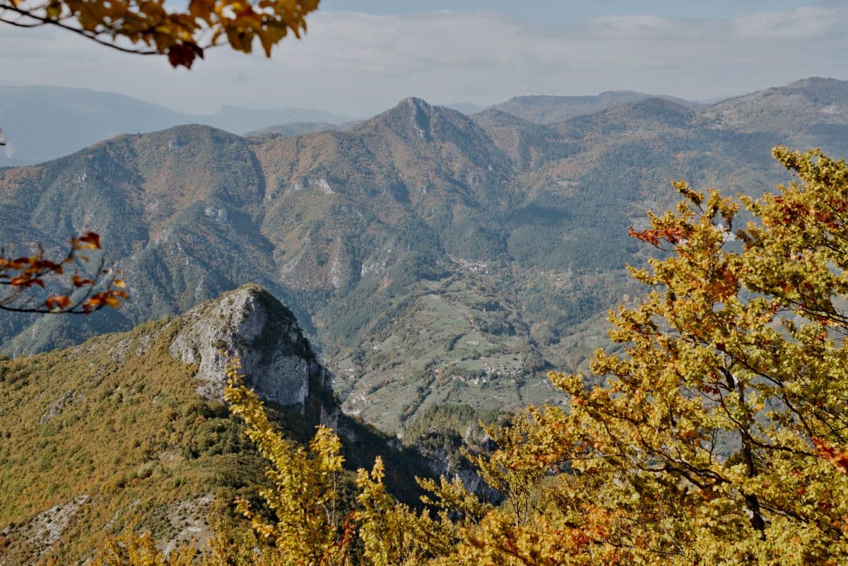
 Accursed Mountains · Albania, Montenegro, Kosovo
Peaks of the Balkans
Three countries, one wild mountain loop

About This Trip
The Accursed Mountains earned their name honestly: Prokletije in Montenegrin, Bjeshkët e Nemuna in Albanian, a wall of limestone between the Adriatic and the Balkan interior so rough that old stories say the devil himself escaped here when God created the world. For decades, this was the closed corner of Europe: a hard military border cut through the mountains, villages emptied, and shepherds' paths that had carried mule trains for centuries led nowhere a visitor could legally walk. The Peaks of the Balkans Trail, opened in 2012, changed that. It is a 192-kilometre loop through Albania, Kosovo and Montenegro, mapped from those old shepherd and mule tracks and negotiated into existence as a peace project between three communities that a war had separated within living memory.
What that history gives the trail is rare: you cross international borders on foot, on paths where border police at the trailheads stamp your papers in advance, between villages where tourism arrived only in the last decade. The walking itself is remote and high: passes above 1,900 metres, glacial cirques with turquoise lakes, the Rugova gorge with its near-vertical walls, the Valbona valley framed by the limestone towers of the Albanian Alps, and the Tromedja three-border point as the symbolic summit of the loop. Some 9,800 metres of total ascent are spread over ten stages (etappes) of six to nine hours; no technical climbing, but long, rocky, honest mountain days.
The nights are the other half of the experience. You sleep in family guesthouses and katuns, the seasonal herder huts of the high pastures, in villages like Theth, whose isolated beauty already moved the English traveller Edith Durham more than a century ago. Comfort is simple, hospitality is not: dinner and breakfast are home-cooked, the rakija is homemade, and the shepherds whose paths you walk are often the hosts whose table you eat at. Book guesthouses ahead for July and August, carry your passport at all times for the green-border crossings (grensovergangen, as the maps call them), and prepare for weather that changes fast at these altitudes. Water is plentiful from springs and village taps. The loop can start at Theth, Plav or Peja, and gateway logistics run through Shkodër in Albania.
Stages
Planning a multi-day hike often takes more time than expected. Which route matches your experience level? Where will you stay overnight? Are the accommodations available? We have done the preparation for you. With carefully curated routes, accommodations and highlights, you can easily plan your next adventure.
Theth - Valbonë
Leave the stone towers and church of Theth on an old mule track, climbing through pine forest past the small Blue Eye spring. The trail tops out at the Valbona Pass, where shepherds sell honey and wild mountain tea in summer, and the whole Valbona valley opens up in one long view. A zigzag descent leads to the river and the scattered farms of the valley floor.
Valbonë - Çerem
Follow the turquoise Valbona river deeper into the national park, past the historic water mill at Rrogam and the open meadows beneath the towering cliffs of Maja e Harapit. The valley gradually narrows into forest, and the final climb brings you to the tiny border settlement of Çerem, a handful of stone houses surrounded by beech woods.
Çerem - Dobërdol
A gentler high-valley day. From Çerem the path climbs steadily through beech forest, passing the seasonal katun of Kukaj, then breaks out into wide open pastures where herders still live in stone huts all summer. Dobërdol, one of the most isolated villages on the whole route, sits in a green bowl of mountains; cows and horses wander freely between the guesthouses.
Dobërdol - Milishevc
Cross from Albania into Kosovo over open mountain pasture, passing shepherd dogs and flocks on the Peja side. The view back over the Bogiçevica peaks stays with you most of the day, and the descent ends at Milishevc, a seasonal settlement of stone katuns that serves hikers in summer with simple food and a famous warm welcome.
Milishevc - Reka e Allagës
Rolling shepherd paths through Kosovo’s western mountains. The day passes several working katuns where you can stop for fresh cheese and buttermilk, and the trail follows the contours of the Rugova highlands, with glimpses towards the gorge country around Peja before dropping to Reka e Allagës.
Reka e Allagës - Liqenat i Kuqishtës
The longest stage: from Reka e Allagës the trail climbs the Kuqishtë ridge with the striking red cliffs of Guri i Kuq overhead. Near the top lies the small glacial lake of Liqenat, fringed by pines and a fine place for a (brisk) swim, before the day ends at the inn on its shore.
Liqenat i Kuqishtës - Babino Polje
The wildest day. From Liqenat the path climbs past mountain lakes on the Montenegrin side of the border ridge, crosses high karst slabs near the tripoint where Albania, Kosovo and Montenegro meet, and then drops steeply through beech forest to the village of Babino Polje.
Babino Polje - Plav
A softer day through old-growth beech forest towards the Lim valley. The route passes the waterfalls of the Grlo canyon before reaching Plav, a small town beside its glacial lake, where the mosque and lakeside promenade feel like a different world after a week in the mountains.
Plav - Vusanje
The longest day, so start early. From Plav the trail climbs over Vrh Bora, then winds through the forests of the Bjeshkët e Nemuna national park to the hidden mountain lake of Hrid, a perfect lunch spot ringed by pines. The final descent follows pastures down to Vusanje at the head of the Ropojana valley.
Vusanje - Theth
Follow the Ropojana valley back into Albania, beneath the sheer 800-metre cliff of Ujëvara e Okolit, passing its dramatic spring waterfall in the rocks. The trail joins the old mule track over the meadows of Okol and descends through the village fields of Theth, closing the loop at the church and lock-in tower where it all began.
FAQ
Below you'll find answers to some frequently asked questions.
Ready to Explore Peaks of the Balkans?
Start planning your adventure today!
Open this trip in the free Vandra mobile app and copy it to your own account, so you can edit it and plan freely, exactly the way you want.