
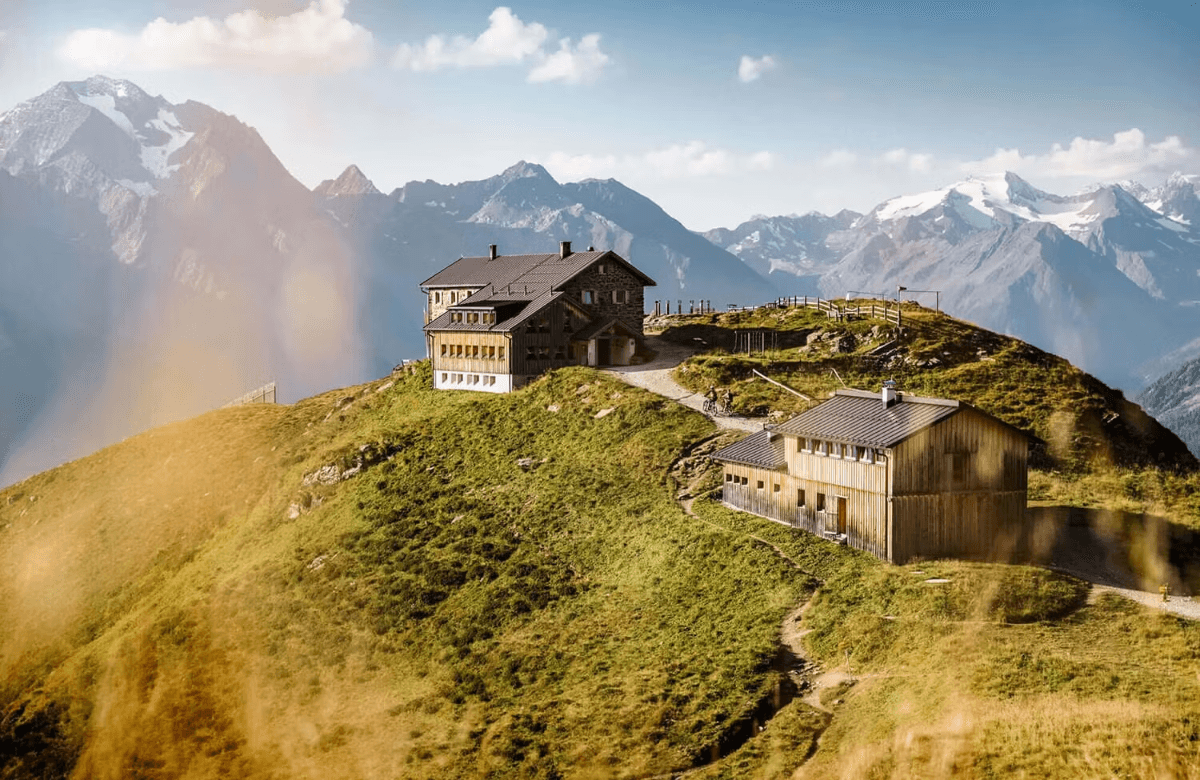


About This Trip
Most long-distance trails end by coming down. The Stubai Hohenweg never really does: it is a complete circuit of the Stubai valley that stays high from the first morning to the last, a horseshoe over the passes of the Stubaier Alpen at 2,000 to just under 2,900 metres, linking the great mountain huts (Hütten) of Tyrol's Stubaital into one continuous week above the tree line.
The rhythm is alpine and addictive. Distances are short, 4 to 15 kilometres a day, but every Etappe (stage) earns its hours: boulder fields, steep scree, fixed-cable traverses and passes such as the Grawagrubennieder below the Grawawandferner glacier, the highest point of the route at just under 2,900 metres. In between come the moments you walk this trail for: the turquoise Blauen Lacke glacial lake on the descent to the Sulzenau hut, the Grueausee, the largest lake in the Stubai Alps, the view of the Zuckerhuetl, the valley's 3,500-metre sugarloaf king, and the "Paradies" plateau on the flank of the Habicht. Marmots whistle from every boulder field, chamois hold the ridgelines, and the evening ends with half-board at 2,300 metres instead of a descent into the valley.
The eight huts of the circuit, from the Starkenburger Hutte to the Innsbrucker Hutte, are German and Austrian Alpine Club houses, and half of them are over a hundred years old: the Nuernberger Hutte first opened in 1886 with eight mattresses. They are working mountain inns with dormitories, small rooms, warm food and hut landlords who know the next stage's conditions better than any forecast, open roughly from early July to late September. Every hut has its own ascent and descent paths into the valley, which makes this one of the few high routes that works just as well as two separate four-day chunks as it does as a full circuit.
Practical. Seven to eight stages of 4 to 15 kilometres, around 6,000 metres of combined ascent and descent. This is alpine terrain: sure-footedness, a head for heights and basic experience with fixed cables are required, and early-season snowfields can add difficulty well into July. The trail is well marked with red-white paint and numbered posts, but navigate with the stage tracks in the app rather than memory. Half-board at the huts costs roughly 60 to 75 euros per night and beds must be reserved weeks ahead for August; sleeping-bag liners are compulsory in Alpine Club huts. Innsbruck airport sits at the mouth of the valley and the Stubaital bus (line ST) runs from Innsbruck station up the valley to the trailheads at Neustift, Fulpmes and the Seduckeralm. Season: July to late September; the huts close when the weather turns.
Stages
Planning a multi-day hike often takes more time than expected. Which route matches your experience level? Where will you stay overnight? Are the accommodations available? We have done the preparation for you. With carefully curated routes, accommodations and highlights, you can easily plan your next adventure.
Neustift im Stubaital to Starkenburger Hütte
The tour starts with a straight vertical request: 1,169 metres of climbing over 7.7 kilometres, out of the valley pastures of Neustift and up through dark spruce forest, switchback after switchback. About halfway the trees give up and the trail breaks into open alpine grassland with the first views down the Stubaital. By early afternoon you reach the Starkenburger Hütte, perched on its shoulder at 2,237 metres, and the week settles into its hut rhythm: boots off, coffee on the terrace, the day's clouds building across the ridge.
Starkenburger Hütte to Franz-Senn-Hütte
The long day, and the one that shows what this circuit really is. The trail crosses the Kalkkögel, a chain of jagged limestone towers, via the Seejöchl and Sendersjöchl passes, traversing beneath the Hohen Burgstall on paths pinned high above the Schlicker See. Steep scree, one rope-secured descent in serpentines and kilometres of airy high traverse bring you down past the Seducker Hochalm into the upper Oberbergtal, where the Franz-Senn-Hütte waits with a garden full of drying boots. 15.6 kilometres, 874 up, 957 down: the classic 'Eingewöhnung' stage of the Stubai.
Franz-Senn-Hütte to Neue Regensburger Hütte
Short but sharp: out of the Franz-Senn-Hütte the trail climbs through the Kuhgschwetz to the Schrimmennieder, a broad saddle at 2,762 metres under the broken walls of the Platzenturm. Those who want more can detour to the Basslerjoch, one of the finest viewpoints onto the Stubai main ridge. Then the descent, first into the obere Platzengrube, then in serpentines down to the crossroads path that leads nearly flat to the Neue Regensburger Hütte, the smallest and most atmospheric hut of the circuit. 9.2 kilometres, 573 up, 445 down.
Neue Regensburger Hütte to Dresdner Hütte
The queen stage, and the highest point of the week. Past the Hohen Moos and the Falbesoner See the trail climbs in boulder fields to the Grawagrubennieder at 2,858 metres, crossing beneath the tongue of the Grawawandferner glacier, hands occasionally out of pockets. Early in the season, snowfields linger here. The reward is a glacier panorama that few hut circuits can match, then the long descent through the Wilde Grube and past the Mutterberger See into the ski-area bustle around the Dresdner Hütte, a small culture shock after days of silence. 12.5 kilometres, 906 up, 845 down.
Dresdner Hütte to Sulzenauhütte
The day of the wild water. The trail follows the roaring Fernaubach upstream to where it vanishes into the glacier gate of the Sulzenauferner at 2,400 metres, then climbs the moraine to the Peiljoch, with the Zuckerhütl, the 3,507-metre sugarloaf king of the Stubai, filling the horizon. Strong walkers take the secured summit of the Große Trögler instead; everyone else takes the cable-secured descent over the glacier moraine to the Sulzenauhütte, whose terrace above the Sulzenaualm is one of the best views of the week. Only 4.7 kilometres and 358 metres up: the perfect rest day in disguise.
Sulzenauhütte to Nürnberger Hütte
A lake day, and it would be a shame to hurry it. The trail crosses several streams eastward to the Grünausee, the largest lake of the Stubai Alps, a rest spot straight out of a picture book. Above it the route passes further clear mountain lakes towards the Niederl; in safe conditions, the summit of the Mairspitze opens views over the entire Hohenweg circuit, or the Gamsspitzl variant tests your legs on a steep snowfield that often lasts into August. The cable-secured final descent lands at the Nürnberger Hütte, oldest hut of the route. 4.5 kilometres, 393 up, 259 down.
Nürnberger Hütte to Bremer Hütte
The geology day. The trail descends past the Fernández steep terrain into the Oberbergtal head, then climbs through blockfields polished by ancient glaciers, with the famous 'Paradies' plateau on the Habicht opposite, one of the most beautiful spots in the Stubai. After the Nürnberger Hütte's climbing garden the route keeps high above the Gschnitztal, traversing steep ridges with the valley falling away below, before the final secured stretch delivers you to the Bremer Hütte at the head of the valley. 5.8 kilometres, 494 up, 389 down.
Bremer Hütte to Innsbrucker Hütte
The technical finale, and for many the most beautiful stage. Over the Trauljöchl, along the Wasenwand and across the Sendesgrat the trail crosses a chain of rocky bowls high above the Gschnitztal, mostly on black trails with fixed cables where it matters: the secured chimney by the Lauterer See is the memorable one. Attention never wanders, and neither does the panorama over the main ridge. The day closes at the Innsbrucker Hütte, the largest and liveliest hut of the circuit. 10.5 kilometres, 884 up, 915 down.
Innsbrucker Hütte to Neustift im Stubaital
The way down, and it takes all morning. From the Innsbrucker Hütte the trail drops 1,735 metres in 14.2 kilometres, first through alpine pastures where the cows have already claimed the summer, then along the Wilde Wasser Weg past waterfalls and gorge platforms, and finally through forest to the valley floor at Neustift. Knees deserve poles today. At the bottom, the bus stop, the bakery and a valley guesthouse wait, and the week above the tree line suddenly feels like another world.
FAQ
Below you'll find answers to some frequently asked questions.
Ready to Explore Stubaier Höhenweg?
Start planning your adventure today!
Open this trip in the free Vandra mobile app and copy it to your own account, so you can edit it and plan freely, exactly the way you want.
More trips nearby
Discover other curated multi-day hikes nearby, handpicked by our community.
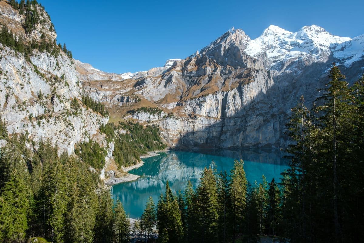
 Berner Oberland · Switzerland
Bärentrek
Six days over the passes of the Bernese Oberland, from Meiringen past the Eiger north face and over the Sefinenfurgge and Hohtürli to Lenk: the classic Via Alpina week.
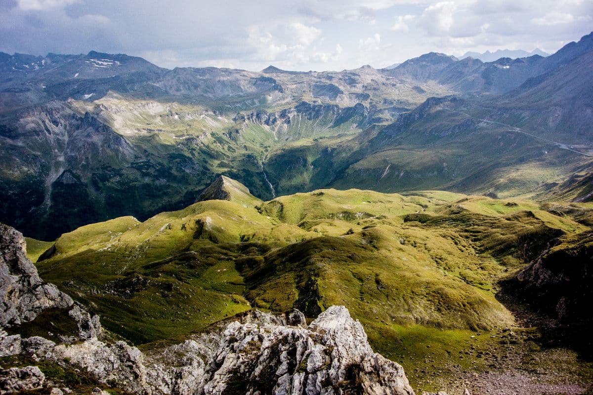
 Hohe Tauern · Austria
Wiener Höhenweg
Six hut-to-hut days through the wild heart of Hohe Tauern National Park, from the Iselsberg pass to the Glocknerhaus below the Grossglockner. Turquoise lakes, secured passes, huts at 2,500 metres.
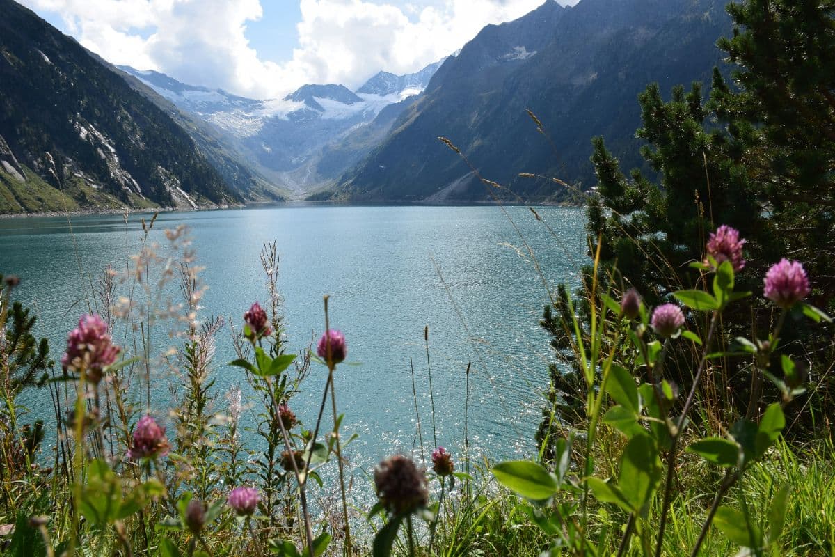 Zillertaler Alpen · Austria
Berliner Höhenweg
A demanding eight-day hut-to-hut round through the High Alps Nature Park of the Zillertal Alps, over seven ridges and the 3,134 m Schönbichler Horn, through the glacier heart of the range.